Windows
Mac
Windows
Log in / Sign up
Windows
›
Tags › terrain maps
Most popular
Terrain Maps
software
Relevance
Popularity
Rating
Design to Field Importers
free
646
Leica Geosystems
Design to Field is the name of a software component contained within the Leica Geo...
include control points,background
maps
, digital
terrain
Plex.Earth Tools for AutoCAD 2010-2015
497
Plexscape
Plex.Earth is an AutoCAD plugin that allows you to use satellite imagery...
terrain
information from online services such as Google
Maps
...automatically zoom
Map
Explorer
Plex.Earth Tools for AutoCAD 2010-2017
228
Plexscape
Plex.Earth provides the tools to utilize aerial/satellite imagery and terrain data, by connecting to Google Earth/Maps...
terrain
data, by connecting to Google Earth/
Maps
, Bing
Maps
...Civil 3D,
Map
3D, Architecture
FSDreamTeam OHareX FSX
95
VIRTUALI s.a.s.
Chicago O'Hare Airport is a scenery developed for Microsoft Flight Simulator X (FSX)...
FS9. Ground
terrain
seamlessly integrated with Flight...like bump and specular
mapping
. Fully 3d
KKND2: Krossfire
88
Beam Software
KKND2: Krossfire takes all that was hailed from KKND and KKND Xtreme and whips it up...
KKND2: Krossfire takes all that was hailed from KKND and KKND Xtreme and whips it up
FSDreamTeam Las Vegas McCarran FSX
73
VIRTUALI Sagl
Las Vegas McCarran is a scenery developed for Microsoft Flight Simulator X (FSX) and Flight Simulator 2004...
and FS9 - Ground
terrain
seamlessly integrated...like bump and specular
mapping
. Fully 3d
FS Instant Approach
66
FSInventions
FS Instant Approach is an add-on for Microsoft FSX and FS2004...
to approach and save
maps
...and view them against
maps
or satellite
terrain
on Google
VTBuilder
free
63
Virtual Terrain Project
Virtual Terrain Builder is a tool for viewing and processing many kinds of geospatial...
Virtual
Terrain
BKOOL Video Route Editor
free
53
BKOOL
BKOOL Video Route Editor allows you to mix video with GPS map data. You can synchronize...
mix video with GPS
map
data. You can synchronize...of interest in the
map
. If you don't...it on the
map
KaM Remake
free
33
Krom, Lewin
KaM Remake is a free add-on for the Knights and Merchants: The Peasants Rebellion strategy game...
and play various
maps
...your
maps
with the
map
editor and exploit the
terrain
AirPhotoSE
free
31
TUVSW
AirPhotoSE offers essential features needed for rectification of oblique aerial imagery with geo-referenced output...
atmospheric defraction and hilly
terrain
is included...aerial images with
maps
, orthophotos
Flight One Software - GTN Series
24
Flight One Software Inc.
The real-world GTN series gauges feature fully integrated GPS...
and easy access to
terrain
mapping
, graphical flight planning, charts
Osm2garminGUI
free
23
Google Code
Osm2garminGUI is a Java/NetBeans RCP application...
planet data, add
terrain
contours generated...generate garmin-compatible
maps
in a single step
ATM Viewer
free
21
Snowflake Software
ATM Viewer allows you to visualize AIXM, IWXXM and Digital NOTAM files. Main features...
Flat Earth views. 3D
Terrain
support. Smooth airspace...your own OGC Web
Map
Service
WPlanner
free
9
Budda T
WPlanner is a standalone program for planning out maps for Wurm. It works much like...
on the
map
to place it. It includes
terrain
, objects
ProJob
free
5
Prolec Ltd
ProJob is a free software utility supplied by Prolec for use with Digital Terrain Maps...
for use with Digital
Terrain
Maps
(DTM)...utility for viewing digital
terrain
maps
Arcade Tactical Simulation
free
5
Falco Software Company
Arcade tactical simulation. This is a tidy 3D, first-person shooter arcade game...
destroy targets on different
terrain
maps
to score points...on and unlock new
maps
, weapons and grow
Combat Mission Battle for Normandy
4
Battlefront
Combat Mission - Battle for Normandy (CM:BN) faithfully recreates the experience...
1 meter
terrain
mesh allows for stunningly realistic
maps
that go
IrriPro
free
4
Irriworks Ltd
IrriPro is the most advanced software on the market capable of designing irrigation...
pipes, etc) and of a
terrain
, not only as edge...by using Google Erth/
Maps
service or importing
Terracopter
free
1
Dewire
3D software performance used to be an issue. With Terracopter that is no longer the case. Real...
terrain
height, land usage, building geometries, aerial photographs, coverage
maps
1
2
3
4
5
6
Tags
Terrain
Flight Simulator
Data
Map
Simulation
3D viewer
Shooter game
Game editor
Select airports
Lens distorsion
Featured stories
See all
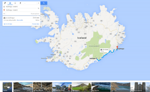
More Opportunities For Trips With Google Maps
Google Maps has recently released a new set of features that will definitely improve user traveling experience.
Mind Mapping Tools: Not To Lose Bright Ideas
Here goes a list of mind mapping tools that will surely help visual thinkers avoid half-concepts and patchy schemes while brainstorming.
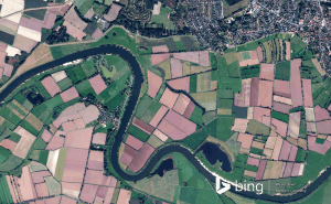
New Bing Maps Preview Focuses On Travelling Plans
Bing Maps Preview has just been updated with a few features that make planning your trips much more convenient.
Halo 5's map editor is now available for free in Windows 10
Unfortunately, Microsoft didn't give us any official information about when or if the game itself will be coming to Windows 10.
Draw on Windows Maps
The default Maps app that Windows offers gives you some very handy drawing options. Here's everything that you need to know about it.